 |
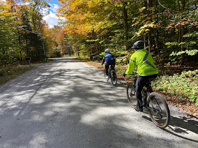
| Judy Behrens & John Blye on Fred Snow Road |
The Fall Foliage Gravel Grinder, or F2G2, is back after a 3 year break due to obvious reasons and you couldn't have asked for a better day for this ride. Will's wife dropped him off at the start point as she was heading up to Boston. Originally, Will and I were going to ride with John and Judy (pictured above) but they headed off at 8 AM. Will and I left the Tyringham Fire Department at 8:30 AM.
We hit First Dirt 2.4 miles into the route on McCarty Road, which also turned out to be the first climb on the route according to Garmin Climb Pro. I had mine set to all climbs and Will's was set to only big ones. Mine said there were 9 and he had 8.
When we headed out I waffled on whether or not put on my over booties and decided to go without them and that was the first mistake on this ride. I should have worn them because by the first climb my toes were freezing. In fact, my toes were numb for all of 40 miles of this 60 mile ride.
At the first rest stop I asked if they had any toe warmers and they did not, but one of the people running the ride hit all the convenience stores between October Mountain State Forest and New Marlborough and had them at the last rest stop but by then my toes were good. Fortunately, someone else needed them so it wasn't a total waste of effort. Goes to show you how well supported this ride was.
The view at the top of the first climb was breathtaking!
The route was heading towards that dirt road pictured above on the left.
There's a loose, rocky, and very steep descent on Breakneck Road. I guess that's where it gets it name from!
Among the 8/9 climbs on this route, three stand out: George Canon, Schermerhorn Hill, and Curtis Street. According to Ride with GPS, both George Canon and Curtis Rd are category 3 climbs and Schermerhorn Hill is a category 2 climb. They first one of the big steeps is George Canon which Will and I found when we were exploring dirt roads in and around Becket, MA, on a parents weekend when our daughters were attending Camp Chimney Corners back in 2014.
George Canon from Mark on Vimeo.
I made this video of us coming down George Canon and Will almost crashed into me on that descent. It was wicked! George Canon wasn't added to F2G2 until 2018 when Berkshire Cycling Association started running the event from the Tyringham Fire Department and it has always been a climb.
I was riding without gloves with my jacket and jersey both open but my toes were still cold
Will is a much faster climber than me and in no time he was nowhere to be seen.
I was wishing once again that I had a 36 or 32t chainring up front.
Apparently, the last house on the left before you turn on Goose Pond Road has a cannon out front.
The next segment of gravel starts in October Mountain State Forest, about 15 miles into the route.
You ride along Housatonic River and there are some really nice views up river.
The wind on Saturday was coming from the north which made riding through here much more colder.
Then came the steepest climb of the ride: Schermerhorn Hill
The first 2 miles is paved which is a joy compared to the first time we rode up this way when it was all washed out.
The dirt starts after the worst part of the climb at around a mile and a half up the hill
At the top is Anderson Vista and the first rest stop of the ride. From here you can look out over the Housatonic River Valley and see the Zephyr Wind Turbine at Jimny Peak, the line of wind turbines on the ridge of the defunct ski area Brodie Mountain and off the to right and obscured by trees in the picture above is Mount Greylock.
Here's a better view of Mount Greylock
Dead center in the picture above you can just make out the tower of Jimny Peak's Zephyr
Time to recharge and refuel
There was an awesome assortment of snacks, too.
Then we were off again. My toes warmed up walking around at the rest stop.
My toes were cold again descending West Branch Road
Turning south we rode along the dyke that contains the October Mountain Reservoir
Fall Foliage through here was spectacular
Will pulled ahead and fell into a pack of guys that his friend Paul Crowell was riding with and they took a wrong turn. Will and I doubled back to get back on the course
Paul and his group rode to the dam and then walked their bikes up the face of the dam
This wonderful dirt section is 7 miles long
Then turns to pavement for 2 miles of rollers before a big downhill descent into Becket, MA
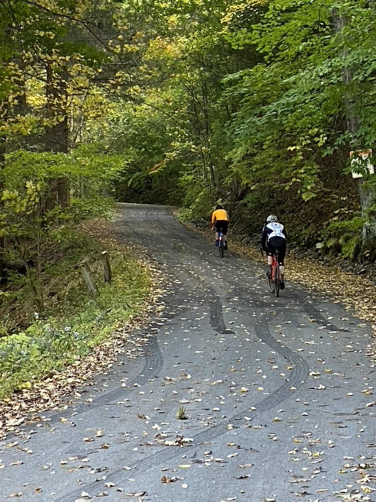
The climb up Fred Snow Road is also worth mentioning because it is also a long one. It goes by Canterbury Farm where F2G2 first started from in 2014.
My toes were starting to warm up again on this climb as was the temperature
It was here that we caught up with John and Judy
Crossing over Rt 20 the road changes name to Johnson Road and once you cross over the Mass Turnpike then you start the descent down to Otis
Shortly after this point Merritt Road had some new black butter and the length of dirt on this road was cut in half
Ed Jones Road also had new pavement, unfortunately, too.
This was next rest stop and 36 miles into the ride at this waterfall on the West Branch of the Farmington River
It was lunch time and time to fuel up again for the next climb
This climb used to be all dirt and it was really tough and even though it is now paved it's still a tough climb!
At the top of the climb does it turn to dirt again.
and is around 3.5 miles of dirt with some small paved sections in between.
On West Center Road there was a punchy gravel climb that saw some feet from the 40 mile riders
We started coming across more of the 40 mile course riders
We were riding with these folks from Greenwich for a bit
Then we headed down Cronk Road and it seemed to me that in the past this road wasn't always in the best shape but today it was stellar!
From Cronk we turned onto Sandisfield Road and my Climb Pro alerted me to a 7% climb that Will didn't have on his and then we turned onto Wallace Hall Road.
It's a really loose, sketchy descent and I immediately recognized it from a ride I did through this spring,
The Maibock Roubaix, where I led a bunch of Gravel Riders from the Norbrook Farm Brewery up into Sandisfield, MA.
Everything now was looking very familiar
And then we were at what I call the The New Marlborough Money Shot but is also called the Steeple Top Preserve on the map.
 |
| 2015 F2G2 |
There used to be rocks near the side of the road but they have been removed.
The hills in the center of the picture above is the backside of the Catamount Ski Area and part of the Mt Washington State Forest, home to the Mt Riga Road and Sunset Rock dirt road climbs. If you haven't ridden these yet, you have to, and feel free to curse me all you want on these climbs.
What's wrong with this picture?
The second mistake of today's ride was that I forgot my frame bag that contained spared tubes! Doh!
Finally, at the last rest and the guy behind the woman on the left found toe warmers but I didn't need them because my toes finally warmed up after 49 miles. Someone else, however, needed them so it wasn't a total waste of effort.
There was more climbing after the rest stop of course on Old North Road
and then the road turned into doubletrack,
which proceeded to get worse and worse before it got better to ride.
Turning onto Gould Road there was just 10 miles to go.
Gould Road appears to have gotten better from what I remember in the past.
Then came the last climb, which was also the longest.
At this stage in the game you have to dig deep for this one
We came upon more the riders doing the 40 mile route
Turning onto Brace Hill was a real sloppy treat
It was really wet initially
then got nicer for awhile
however it was badly washed out on the descent
I was just happy to make down alive!
A couple of minutes later Will came down.
He doesn't like trails and took it slow.
This guy was on an e-Bike but he was over 70 years old. Good for him that he's still riding!


No comments:
Post a Comment
Please, stick to the topic at hand. Links to other sites or spam content will be removed.