Sunday, May 31, 2020

Pandemic Roubaix to Brew: OEC revisited

One of the things that I like about where I live is that my gravel/mixed terrain rides can start on a dirt road as close as a quarter of mile away. Today's ride hit First Dirt on Tamarac Road.


The goal of today's ride was to explore Stiles Road that used to connect Southbury to Woodbury.  Ride up the Trolley Bed to Tuttle Road and then check out Old East West road that runs through the middle of the Whittemore Sanctuary. Ride the Middlebury Trolley Trail, to Hop Brook Park, get on the portion of the old Railroad bed through there and then take the Larkin Bridle Trail down to OEC Brewing. Lastly ride the top part of Nelson Road.

Friday, May 29, 2020

Brown baggin' a PBR

Summer hours started officially today and when I went to get ready to ride after work I discovered that the Bondeye had a flat tire. So I came up with an alternate plan which was to take the CAADx on a dirty thirty adventure into Roxbury to ride the lower section of the Shepaug Rail Road bed.  The only legal approach to it is from a single track trail off of Minor Bridge.


Sunday, May 24, 2020

I found Huggy Bear's car in upstate NY

My Sister-in-law conspired with my wife to give our daughters some time together after they both have been secluded in our houses for so long due to the Pandemic. My daughter and I drove up to Spencertown. There are a lot of dirt roads up in Columbia County but if you stick to numbered county roads you can avoid the dirt. I planned a route from their place, up to Stephentown, over the Brodie Mountain Road and then back to Spencertown.


Riding up County Road 295 we came across the is pimp Lincoln Continental. I immediately thought of Huggy Bear but later I found out he drove a Grand Torino. Still, those opera windows on the side remind me of my Grandmother's Lincoln. It was blue with a white top and had the softest leather seats. 


Friday, May 22, 2020

Pandemic Roubaix to Brew: Kent Falls Brewing


We had a half day on Friday for the start of the holiday weekend. I changed packs on the CAADx because I wanted to ride to Kent Falls Brewery, buy a four pack, drink one and carry the other three home. Much easier than a growler.


Thursday, May 21, 2020

Ride after Work: Dirty 30

I headed out of the Bat Cave on the CAADx to Pond Brook Road and then made my way south through Bethel by way of Cod Fish Hill. My goal this evening was to hit Old Poverty Hollow. There aren't many dirt roads in between unless you want to ride through Huntington State Park.


Old Poverty Hollow is a gravel paradise. It's mostly flat, rarely do you see anyone else on it and there is a really nice place to stop towards the end with a nice view of the stream running through.


Riding through here is one of the two routes that I for bike commuting. On the way in, if I am riding this way I can get three dirt roads in on my way to work: Head of Meadow, Old Forge and Old Poverty Hollow. I seldom come back this way because it's longer and usually I just want to get home after work.

Looking back toward Mountainside Rd

Working my way back towards Newtown, I went up Mountainside Road which turns to dirt half way up the road. According to the old topo maps this road used to go through to Jet Brook Road in Newtown. While the old ROW is nearly impossible to ride, that is if I didn't have road gears on my cross bike, there is a nice little trail system off to the west. It looks like a dirt bike track and what I found is it too comes out on Jet Brook. Have to try it in the other direction some time.

Looking up hill
Jet Brook pops out onto Castle Meadow and the next abandoned road I wanted to try was Maltbie Road.


On the way up Maltie I noticed this sign which is kind of a conundrum. Does this mean that you should slow down because there are Yuppies about or this is an area for slow Yuppies. Very similar to all the Slow Children at Play signs.


The Maltbie ROW is a hidden gem that I can't believe that I have overlooked for so long.  Looks like it gets some horse traffic, too.


The north side is bordered by Newtown Open Space and I didn't see it but apparently there is another abandoned road that intersects it as well.


And then there is a stream running through the middle of the trail.


But since it's open space to the north (left of the picture) there is the possibility of building a reroute.


The climb out doable but a little sandy.  Eventually you come out on to Hundred Acres Road. From here you have a couple of dirty choices to choose from: ride around to Mt Nebo and then come down Ox Hill, ride through Cherry Grove, or ride to Beaver Dam. 


I took the latter route and did my normal route home: Beaver Dam, Bentagrass, Point of Rocks, Deep Brook, and then Old Echo Valley to Sanford Road. 


Wednesday, May 20, 2020

Scrabble Cross

I dusted off the CAADx this weekend and decided to take it out on a ride after work. This bike has primarily been my commuter bike but since I am no longer commuting I figured it needed some loving. Of course having fatter tires meant that I should try and hit all the dirt roads that I possibly could this evening.


On my last mixed terrain ride through this area I found Sturges Road impassible so I took it off my map (Roubaix to Brew) and I had once prior looked for the Wildcat Lane ROW but didn't find anything at the end of the Bobcat Lane cul-de-sac but I recalled looking at the town GIS map and seeing that is still listed as a ROW and now that I know where to look for it, I found it this time and gave it a shot. One note, the trail starts on the other side of the grass. 


There are few trees down that interrupts the flow. Some you can hop and others are too big or too high. Might have to ride through again with a hand saw and cut a few so that you can at least bunny hop them.  Once I was on Plumtrees I started looking for a trail to access Newtown Forest Association's Brunot Preserve but didn't see anything. I did find a somewhat obscured entrance to the neighboring Bethel Land Trust and it's buff trails were easy to ride. 


The separation between the BLT trail and the Brunot Preserve is the yellow chain stretched between two trees.  The Brunot Preserve was donated by the James Brunot's family in the 1970s and he was the guy responsible for introducing the world to Scrabble.


I rode here 15 years ago and it was absolute crap. The trails were savaged by ATVs however, what I found today was a much more improved trail system that I think another visit, this time with the mountain bike would be in order. Trails were pretty buff and no longer rutted out by ATVs. I remember losing the trail once out of the fields but now they are clearly visible and blazed, as well.


The main trail that dumps you out to Taunton Road goes through a hollow and at the center of it is big mud bog. There appears to be another trail that entirely bypasses this area but its fall line and hike-a-bike. Probably better on a Mountain Bike. The map on the NFA website is absolute crap. 


Next I rode to the top of Holcombe Hill which commands one of the best views looking north towards New Milford.


One thing I realized about the CAADx is that it is geared 11-28t, which is not the best gearing for riding trails, something I will have to rectify soon.  From Holcombe Hill I rode down Scudder Road, across Head of Meadow and then up Shepards Hill. Once on the Fosdick trails I noticed that appeared someone had put sticks and leaves on the trail to deter bikers? Didn't deter me at all but its good way for a walker to twist an ankle.


I looped around to the back side of Mt Nebo Road and then road a series of dirt roads that I ride regularly: Ox Hill, Beaver Dam, the Bentagrass connector, Point of Rocks, and Deep Brook. 


Closer to home, I cut over towards the State Forest on Echo Valley and if there is time will take the Brody Forest Road back to Hanover Road but othe temperature was dropping fast and I was starting to get cold. I took Sanford Road instead.

Saturday, May 16, 2020

Pandemic Roubaix to Brew: Big Elm Brewing

Will and I usually ride Mt Riga much sooner as a warm up to the Farmer's Daughter. Between the Pandemic and the crazy weather we have been having this weekend turned out to be ideal to do our annual pilgrimage to Mt Riga. He rode down from his summer home in Spencertown and we met at the Depot Deli in Copake Falls. I was worried that the lot would be filled with everyone trying to be outside right but when I arrived at 9 AM there was only one car in the lot.


In planning the route I decided we would make a beer stop at Big Elm Brewery and split a 4 pack of pints. We each drink one and carry the other back. I made peanut butter and jelly sandwiches. The day prior I did a 75 mile ride and I was wondering how I would do on this ride since Sunset Rock Road to start off is a killer climb.
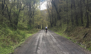


As usual, Will took off and I never saw him again until I got to the end.


The Garmin Climbpro was showing grades well over 20% but RWGPS said the max grade was 19.5%. Maybe that's the difference between map and actuality.


Still, I made it up the hill without stopping!


When we got to Mt Washington Road the state was paving the road. So, we got a little extra gravel while heading down hill. I love this view because it looks directly at East Mountain State Forest and Butternut off in the distant.


I made a slight change to the route so that we would bypass Jug End Road and rather take a road called the Avenue. The nice thing about this is that you don't have to hit the brakes so early and take advantage of all that speed till you get to the Avenue.  The closed section of Giberson Road was exceptionally wet due to last night's raid. One of the advantages of fenders is that I road straight through this and my shoes got a little wet.


Once you get past the puddles its nice and dry.


After Gibberson it was on to Foley Road where the view of the Taconics was splendid.


After lunch Will and I would be riding up those mountains.


According to Wandrer this was virgin road for me.


These yearlings were an inquisitive lot


Grade crossing on the Berkshire Division of the Housatonic Railroad.  Which means, Big Elm Brewery is right up the road!


We split a four pack of Lion's Ale, which is an English amber ale which tastes like a cross between a New Castle Brown and a Bass. Due to COVID-19 restrictions we couldn't drink and eat at the brewery. We headed back to a parking lot back on Silver Street for some land trust open space. The four pack fit rather nicely in my Cannondale Casey Handlebar bag.


I broke out the PBJs and Will brought some smoothies.


The beer was perfect!


And the second pint fit nicely in my back pouch, too.


Looking at Mt Everrett from our lunch spot


We made one little exploration today that turned out somewhat successful. According to the Topography map Mt Tom Road used to go through so on today's ride I decided to check it out.


Yes, it did go through but there were quite a few trees down that needed to be hopped or climbed over.


Hanging a right on North Shore Road we road down to Twin Lakes. Not sure why its called North Shore since its on the south shore of the lake.


From Twin Lakes we bombed down Wildcat Hollow and then rode along the Housatonic River


Stopped off at a scenic spot across from Falls Village.


Then we climbed up to Salisbury where the water at the fountain was running continuously. I planned ahead and brought wipes but thankful for the modification. Will wasn't sure about the water but I have been refilling my bottles here for years. It's Mt. Raggie water!


The Climbpro graph on the Garmin was looking a Rainbow Roll at the local Sushi Restaurant.
6.28 miles to the top!


Mt Riga Road was nice and hard but there were a lot of cars and motorcycles coming up and down the road.


I made one stop to take a picture of Riga Falls.


Nearing the highest point on Mt Riga Road


Max grade according to RWGPS was 12.4% but if I remember correctly the Garmin said it was 19 to 20%.


The Garmin also said it was 2025 feet in elevation


The Sex Machine at the Mt Washington Road sign.
This is the boarder with CT and MA.


The Mass section of Mt Washington Road had a lot of unfriendly to bicycle tire trap rock


Then it was bomb down Bash Bish Road. The State Park was closed and yet there were still people parked there when they weren't supposed to be.